Lake Texoma and the Denison Dam
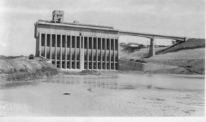
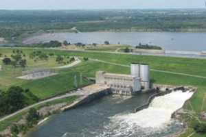
Denison Dam, also known as Lake Texoma Dam, was completed in 1944. Denison Dam is located on the Red River between Texas and Oklahoma about 726 miles from the mouth of the Red River, or sometimes known as the Red River of the South. Lake Texoma is the second largest lake in Texas and the twelfth largest reservoir in capacity in the United States.
The top of the Denison Dam is 165 ft and impounds the upper Red River and it’s tributaries forming Lake Texoma. Normal lake level is 618.8 feet and the top of the flood pool is 640 feet. Lake Texoma has crested the spillway (640’ elevation) a total of five times: 1957, 1990, 2007 and twice in 2015.
Lake Texoma and the Denison Dam are owned and managed by the US Army Corps of Engineers. Denison Dam contains a total of 18.8 million cubic yards of rolled-earth fill. It produces roughly 250,000 megawatt hours of electricity per year, while Lake Texoma provides nearly 125,000 acre-feet of water storage for local communities.
Highway 91 crosses the top of the Denison Dam, connecting Oklahoma and Texas. Access to boat ramps on the Texas side and the Red River on the Oklahoma side, are via Hwy 91 in Texas.


